If you’re planning a Himalayan trek in Uttarakhand, chances are you’ll hear one name again and again—Ghangaria.
Whether you are planning for the Valley of Flowers trek or Hemkund sahib. Your journey likely begins in a small, mist-covered village called ghangaria village.
In this guide, we’ll walk you through everything you need to know about this vital base camp.
Where Is Ghangaria Located and Why Is It Important for Himalayan Treks?
Ghangaria is more than just a pin on a map; it is a tactical necessity for high-altitude explorers. Situated at the confluence of the Pushpawati and Lakshman Ganga rivers, this village is the final point of civilization before you enter the strictly protected zones of the UNESCO World Heritage site.
Geographic Location of Ghangaria
Nestled in the northern part of the Chamoli district, sits at an altitude of approximately 9,600 feet (2,926 meters). It is located deep within the Bhyundar Valley. To get here, one must travel past the famous shrines of Rishikesh, Devprayag, and Joshimath, eventually turning off the Badrinath highway at Govindghat. It is the northernmost point of semi-permanent settlement in this specific valley.
Why Every Trekker Must Pass Through Ghangaria
You cannot stay overnight in the Valley of Flowers National Park, and staying at Hemkund Sahib is prohibited due to extreme altitudes and religious sanctity. This makes ghangaria village uttarakhand your mandatory "home away from home." Every trekker must use this village as a base camp, venturing out at dawn and returning by dusk. It is the only place in the region where you will find electricity, cooked meals, and a bed.
Treks that officially start from Ghangaria
From Ghangaria, you can access:
-
Valley of Flowers trek (~4 km one way)
-
Hemkund Sahib trek (~6 km steep climb)
Both treks start early morning and end back at Ghangaria the same day.
This makes the village strategically important—not just geographically, but also logistically.
What Makes ghangaria Different from Other Himalayan Base Camps
Unlike popular hubs like Manali or Kasol, ghangaria is a "seasonal ghost town." It has a personality that shifts with the monsoon rains and the arrival of pilgrims.
A Seasonal Village: Life in Ghangaria from June to October
For six months, Ghangaria is buried under ten feet of snow. The villagers move down to lower altitudes like Govindghat or Pandukeshwar. It only "wakes up" in late May or early June. Every shop, hotel, and kitchen you see in ghangaria village is temporary, set up specifically for the four-month window of the trek. This creates a high-energy, "pop-up" atmosphere where everyone is working against the clock before the winter returns.
No Road Connectivity: Last Motor Point at Pulna
This is one of the few places where "no cars allowed" isn't a choice—it's a geographic reality. The motorable road ends at Pulna. From pulna village to ghangaria, the only way forward is on your own two feet, on the back of a mule, or via a helicopter. This lack of roads preserves the village's rugged charm but also means every potato and bedsheet you use has been hauled up 9km by a beast of burden.
The Spiritual Aura: The Shared Path of Trekkers and Pilgrims
Ghangaria is a rare melting pot. On one hand, you have adventure seekers headed to the ghangaria to valley of flowers trail. On the other, you have thousands of Sikh pilgrims chanting Satnam Waheguru on their way to Hemkund Sahib. This blend of grit and grace gives the village a unique energy that you won't find at a standard trekking base camp.
Logistical Hub: Helicopters, Mules, and Porters
In Ghangaria, the main "street" is a flurry of activity. It serves as a massive logistics terminal. You'll see the helipad buzzing at one end and "mule parking" at the other. If you find the pulna village to ghangaria distance too taxing, this hub provides the support needed to ensure anyone, regardless of age, can reach the base camp.
Eco-Sensitive Zone and Restricted Development
Because it sits on the edge of a National Park, the Forest Department strictly controls what can be built here. You won't find luxury resorts or concrete jungles. The development is basic, functional, and eco-conscious. This restriction helps maintain the delicate balance of the Bhyundar Valley ecosystem.
How to Reach ghangaria village from Delhi, Rishikesh, and Dehradun
Reaching ghangaria is an exercise in patience and endurance. It is a journey of three distinct legs: the plains, the mountains, and the trail.
The Road Journey: Delhi to Rishikesh and Beyond
Most travelers start from Delhi, taking an overnight train or bus to Rishikesh. From Rishikesh, it is a 10-hour (270 km) drive to Govindghat. The drive is beautiful but exhausting, following the Alaknanda River. For those flying in, Dehradun’s Jolly Grant Airport is the closest, about 45 minutes from Rishikesh.
Pulna Village to Ghangaria: The 9km Trekking Route
Once you reach Govindghat, a shared jeep takes you 4km further to Pulna. This is where the real work begins. The pulna village to ghangaria distance is approximately 9km of paved, but steep, incline. For a beginner, this takes 5 to 7 hours. The path is well-maintained but can be slippery during the monsoon, which is the peak season for ghangaria village tourist places.
Helicopter Services from Govindghat: Timing and Booking Tips
If you want to skip the 9km trek, helicopters operate from Govindghat to the Ghangaria helipad. The flight takes only 5 minutes. Tickets are sold on a first-come, first-served basis at the Govindghat helipad. Pro tip: Flights are highly weather-dependent. If it’s raining, helicopters won't fly, so always be prepared to walk.
Road Conditions and Travel Experience While Approaching ghangaria
Traveling in the Himalayas during the monsoon requires a bit of "mountain wisdom."
Navigating the Rishikesh-Badrinath Highway in Monsoon
The road to ghangaria is part of the main Badrinath route. While the roads are generally wide, the monsoon (July-August) brings the risk of landslides. It is common to be delayed by a few hours as BRO (Border Roads Organization) clears the debris. Always carry snacks and water for these wait times.
The "Gate System" and Travel Restrictions Near Joshimath
To manage traffic on narrow stretches, the local administration often uses a "Gate System" where traffic is allowed to move in only one direction at a time. Between Joshimath and Govindghat, night driving is strictly prohibited for safety. Ensure your vehicle leaves Rishikesh early (by 6 AM) to reach your destination before sunset.
Tips for a Smooth Journey in Monsoon Season
-
Travel in a high-clearance vehicle like a Bolero or Innova.
-
Check weather updates for "Chamoli district" specifically.
-
Keep a "buffer day" in your trip to account for road blocks.
4. Keep extra food and water
Pulna to Ghangaria Trail
The main trail is stone-paved, which is great for mules but tough on human knees. Many trekkers try to take "shortcuts" through the forest. Avoid these during the rain; they are breeding grounds for leeches and are incredibly unstable. Stick to the main path.
Key Destinations Accessible from Ghangaria
Once you reach this base camp, the "Big Two" are your primary targets, but there is more to explore.
Ghangaria to Valley of Flowers: The Floral Haven
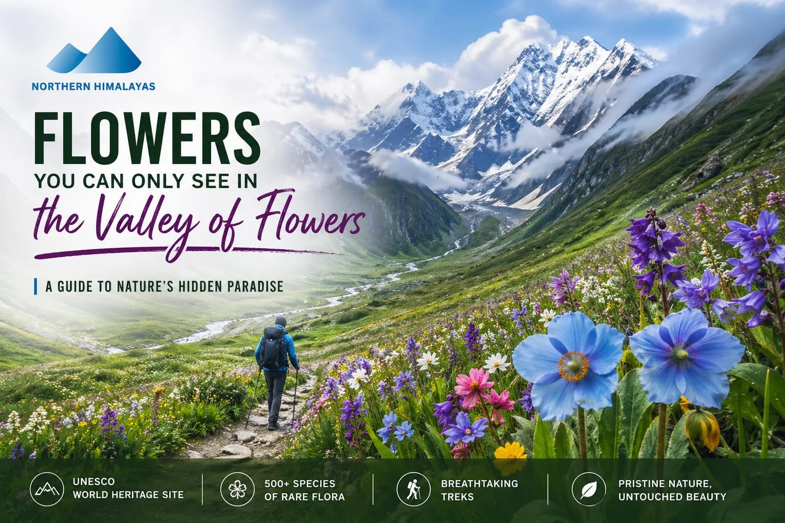
The ghangaria to valley of flowers distance is about 4km to reach the start of the meadows. It’s a relatively easy ascent compared to the previous day. You cross the Pushpawati River and enter a world where the trail is literally lined with blossoms. Remember, you must carry your own lunch as there are no shops inside the park.
Ghangaria to Hemkund Sahib: The Spiritual Ascent
This is the true test of your lungs. The climb to Hemkund Sahib is 6km long and very steep, taking you from 9,600 ft to 15,200 ft. Most people start at 5 AM to reach the Gurudwara by noon. The oxygen level here is low, so take it slow.
Ghangaria to Mana Village Distance
While many ask about the ghangaria to mana village distance, it is not a trekking route. Mana is near Badrinath. To get there, you must trek back down to Govindghat and drive about 25km. It is highly recommended to visit Mana after you finish your Ghangaria stay to see the "Last Indian Village."
Nearby Streams, Forest Trails, and Exploration Spots
If you have an extra afternoon in Ghangaria, walk toward the helipad or follow the riverside trails. The forest around the village is rich in birdlife and offers quiet spots away from the pilgrim crowds.
Ghangaria Village Altitude and Weather
Understanding the environment is key to avoiding what locals sometimes refer to as "Ghangaria disease"—essentially high-altitude sickness.
Surviving 9,600 Feet
Ghangaria is at that "threshold altitude" where the body begins to feel the lack of oxygen. It is vital to spend your first night here resting. If you feel a persistent headache or nausea, it might be AMS. Drink plenty of water and avoid overexertion on your first evening.
Monsoon Weather Patterns: Preparing for Constant Rain
Since the best time to visit is July-August, expect rain. It’s rarely a torrential downpour all day, but rather a persistent mist and light drizzle. This keeps the ghangaria village stay feeling damp, so waterproof packing is essential.
Temperature Fluctuations: Day vs. Night in Ghangaria
Daytime temperatures can be a pleasant 15°C to 18°C while trekking. However, as soon as the sun sets, it can drop to 5°C or lower. Layering is your best friend.
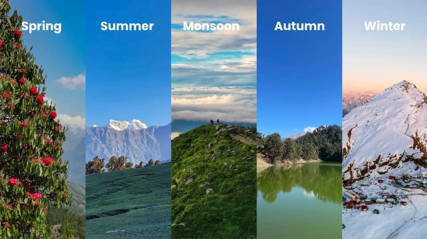
Best Time to Visit Based on Trekking Goals
-
For Flowers: July to August.
-
For Clear Views: September to early October.
-
For Pilgrimage: June (though very crowded).
Where to Stay in Ghangaria: Guesthouses, Homestays, and Trekker Lodges
Accommodation here is "mountain-standard," meaning clean but basic. Don't expect 5-star luxury at 10,000 feet.
Budget vs Mid-Range Accommodation Options
There are several private hotels and the government-run GMVN (Garhwal Mandal Vikas Nigam).
-
Budget: Shared dormitories or basic guesthouses (₹1,000–₹1,500).
-
Mid-Range: Rooms with attached bathrooms and hot water buckets (₹2,500–₹4,500).
Booking Tips During Peak Season
August is incredibly crowded. If you are not on a fixed ghangaria village tour package, you might find yourself without a room. Always book at least 30 days in advance if traveling independently.
What to Expect: Facilities and Limitations
-
Hot Water: Usually provided in buckets for a small fee (₹50–₹100).
-
Electricity: Available but can be erratic during heavy rains.
-
Bedding: Clean but often slightly damp due to the humidity. Using your own liner is a good idea.
Food, Network Connectivity, and ATM Availability in Ghangaria
Types of Food Available for Trekkers
The food in ghangaria is surprisingly diverse. You'll find everything from Dal-Chawal to noodles and even pizzas. Stick to hot, freshly cooked vegetarian meals. The Gurudwara also offers Langar (free meals) to everyone, which is a soulful experience.
Mobile Network and Internet Reality
BSNL is the only somewhat reliable network here. Jio works in patches near the helipad. Do not expect to run Zoom calls or stream videos. Use this as a chance to digitally detox.
ATM, Cash, and Payment Options
There are no ATMs in Ghangaria. The last working ATM is in Joshimath (and it often runs out of cash). Carry at least ₹8,000–₹10,000 in physical cash for your stay, mules, and emergency expenses. Digital payments are almost non-existent due to poor internet.
Responsible Trekking: Leave No Trace Principles for the Ghangaria Village
Ghangaria struggles with waste management. As a responsible trekker:
-
Carry all your plastic wrappers back to Govindghat.
-
Do not use chemical soaps in the river streams.
-
Stay on the marked paths to avoid soil erosion.
-
Respect the silence of the valley; avoid playing loud music.
Why most of the trekkers prefer Northern Himalayas for trek packages
Booking a valley of flowers trek with hemkund sahib through Northern Himalayas is the preferred choice for 2026 for several reasons. Firstly, they have a dedicated ground team in Joshimath base camp and Ghangaria, ensuring you get the best rooms even during the peak August rush time. Secondly, their local guides and trek leaders are experts at identifying the rare flora on the ghangaria to valley of flowers route. Most importantly, they prioritize safety, carrying oxygen cylinders and pulse oximeters to monitor for any signs of "Ghangaria disease" or AMS, making it the perfect choice for beginners.
During the peak season of the valley of flowers trek (July–August), local operators like Northern Himalayas run daily batches, which makes planning much easier for trekkers. You don’t have to wait for fixed dates—just choose your preferred schedule as per your convenience and join a group. And you can customized your itinerary as per your choice and comfort.
Since they operate regularly in Valley of Flowers Uttarakhand, they are well familiar with:
Route conditions and weather changes because this Valley of flowers trek runs in peak monsoon durations, their are higher chances of road block and landslides thus it make this trek more challenging.
Accommodation availability in Ghangaria are less in peak duration, its hard to find clean and hygiene stay in ghangaria.
This helps in smooth coordination, especially during crowded months when last-minute arrangements become difficult.
Another advantage is their affordable pricing:
Their Packages usually start from ₹8,000–₹13,000. These packages generally include stay, meals, permits and basic trek support, making them the best option for beginners and budget travelers.
10 Most Asked Questions About Ghangaria Village, Uttarakhand
1. Is there a mobile network in Ghangaria?
Only BSNL works consistently for calls. Data is almost non-existent.
2. Can I get a helicopter to Ghangaria?
Yes, from Govindghat. It costs roughly ₹3,000–₹3,500 per person for a one-way trip (subject to 2026 rates).
3. Is it safe for solo female trekkers?
Extremely safe. The village is bustling and the local community is very respectful toward travelers.
4. What is the distance from Ghangaria to Valley of Flowers?
It is about 4km to the main valley floor.
5. Are there any ATMs?
No. Carry sufficient cash from Rishikesh or Joshimath.
6. Can I see the Milky Way from Ghangaria?
If the clouds clear in September, the star-gazing is spectacular due to zero light pollution.
7. Is hot water available?
Yes, most hotels provide buckets of hot water for a small charge.
8. What is "Ghangaria disease"?
It's a local term for Altitude Sickness. Symptoms include headache, dizziness, and loss of appetite.
9. Can I visit Hemkund Sahib and Valley of Flowers on the same day?
No. Both require a full day of trekking and are in opposite directions.
10. Do I need to carry a tent?
No, camping is not allowed. You must stay in guesthouses or the Gurudwara.